Proceedings of the 1st Workshop on "Spatial Knowledge Acquisition with Limited Information Displays" [SKALID] @ Spatial Cognition 2012 published.
Doctoral Research
Gaining survey knowledge of a complex spatial environment has proven to be facilitated by so- called You-are-here maps. Following recommendations from the cognitive sciences and psychology You-are-here maps are usually designed as visual medium for visually capable people. The external representation of the spatial environment helps the map-reader to build an internal mental model of his surrounding and to navigate it successfully.
Maps are used to convey abstract information and reasoning about the complex world to the reader in a compact and handy way. The need for such information is not limited to those audiences that are typically addressed by visual maps, but shared by people who cannot use their sight temporally or permanently, who want to supplement their cognition by other modalities, or who have another cognitive style. For visually impaired people tactile emvironmental maps hold the advantage that they convey/ information about their proximate environment that is otherwise not accessible to them. They can gain information about locations that are not directly in the reach of their hands and arms and they can build up survey knowledge about their environment. For visually capable people tactile maps can be a supplementary way to explore the vicinity which could be advantageous for example in situation in which visual information is not available (e.g. in smoky environments, in the dark).
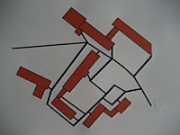
The goal of the ongoing doctoral research is to develop a concept of cognitively adequate tactile environmental maps, i.e. Initially the represented world will be limited to parks, zoos and university campuses.
The project is about to be finished. It will be concluded in autumn this year, according to this project plan (German only) and the complementary page plan.

 Wiki
Wiki


